Newsletter "Beyond the Postcards" Subscribe
Plan Your Cyprus Trip: Hotels: Expedia, Villas & Apartments: Vrbo, Car Rentals: DiscoverCars, Tours: GetYourGuide, Airport Transfers: WelcomePickups
- Home
- Things To Do in Cyprus
- Hiking in Cyprus
- Best Hiking Trails in Cyprus
Best Hiking Trails in Cyprus
Artemis circles the upper slopes of Mount Olympus and brings you back to where you began. The trail between Panagia tou Araka and Stavros tou Agiasmati ends seven kilometers away, at a different Byzantine church. Both are walks in the Troodos Mountains, but they require different plans.
Elsewhere, a trail may climb above the Akamas coastline, follow a river toward a waterfall, or enter the narrow passage of Avakas Gorge. Each offers a different way to experience Cyprus on foot, with its own demands on your time, fitness, and preparation.
These nine hiking trails have been chosen for the experiences they offer and the trade-offs worth understanding before setting out.
Artemis Trail — Troodos Mountains
Artemis is one of the finest introductions to mountain hiking in Cyprus, particularly for travelers who want high-altitude scenery without a demanding ascent.
The seven-kilometer circular route follows the upper slopes of Mount Olympus, locally known as Chionistra, at approximately 1,850 meters above sea level. It passes through black pine forests, rocky formations, and areas where the surrounding mountain landscape opens into extensive views.
Some of the black pines along the route are approximately 500 years old. There are also remains of makeshift fortifications dating from the final years of Venetian rule, an unexpected historical detail amid the natural landscape.
Despite its elevation, Artemis is officially classified as an easy trail. Allow approximately two and a half to three hours, remembering that an easy difficulty rating does not make seven kilometers an insignificant walk.
The trail begins near the junction of the Chionistra road and the Troodos–Prodromos road, rather than directly from Troodos Square.
Artemis would be our starting choice for travelers who want to experience the upper Troodos landscape at a measured pace. Its appeal lies in the forest, elevation, and changing views rather than a single dramatic destination.
Atalanti Trail — A Longer Walk Through Troodos
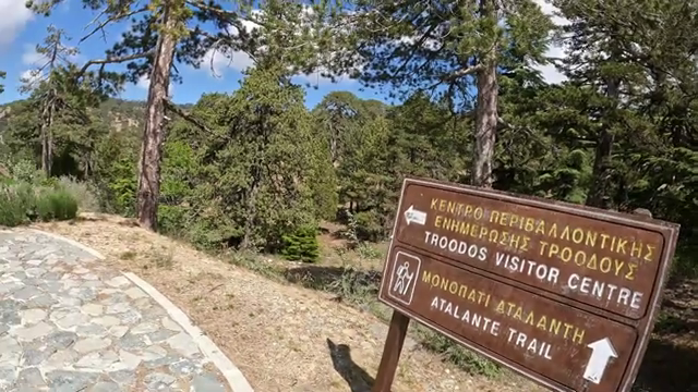 Atalanti Trail, Troodos Square
Atalanti demands a different kind of commitment. At approximately 14 kilometers, it is one of the more substantial hiking routes around Mount Olympus.
Beginning at Troodos Square, the circular trail passes through extensive stands of black pine and juniper while following the mountain at an elevation of roughly 1,700–1,750 meters.
Among its natural features is an ancient juniper estimated to be around 800 years old. The route also passes the entrance of a former chrome mine, a reminder of the mining activity that once formed part of life in these mountains.
The walk takes approximately four to five hours and is officially classified as moderately difficult. Although much of the route avoids dramatic changes in elevation, the distance requires stamina. After approximately nine kilometers, the trail also crosses the Troodos–Prodromos road before continuing along its marked course.
Atalanti makes sense when hiking is the main activity of the day rather than something fitted between other stops.
Compared with Artemis, it requires more time and endurance without necessarily offering a more dramatic individual viewpoint. Its real attraction is the extended journey through the mountain landscape.
Caledonia Trail — Waterfall and Forest Near Platres
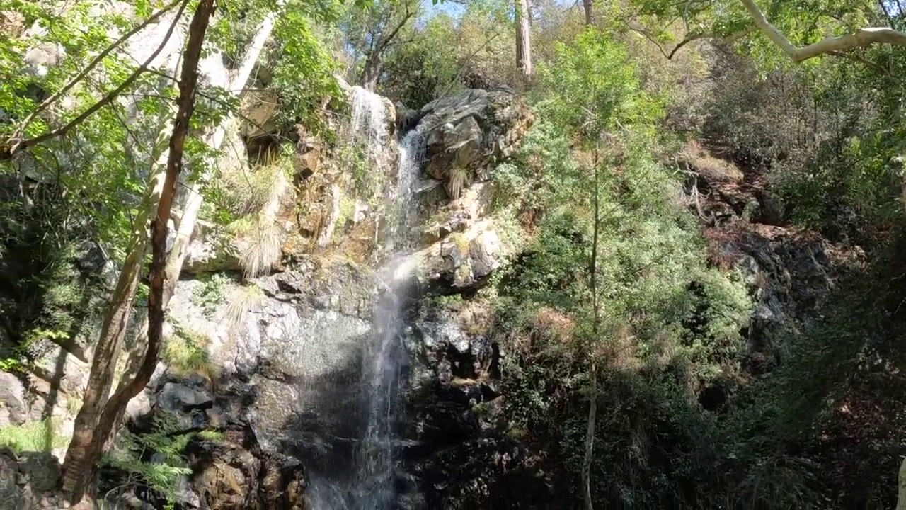 Caledonia Waterfall
The Caledonia Trail follows a different landscape altogether, descending through woodland alongside the Kryos Potamos river toward Caledonia Waterfall.
The river, dense vegetation, and shaded sections create a more enclosed setting than the open mountain circuits around Mount Olympus. Along the route, the presence of water becomes an important part of the experience, particularly where the path approaches the stream and crosses rocky ground.
The approximately three-kilometer linear trail connects the upper Troodos area with Psilo Dentro near Pano Platres. Walking downhill from the upper trailhead, the route loses considerable elevation before reaching its lower end.
Its short distance can be misleading. Caledonia is officially graded difficult because of its uneven terrain, slippery sections, and stream crossings. Allow approximately one and a half hours for the one-way journey, with additional time if returning on foot.
The trail is particularly appealing to travelers who want to experience woodland, running water, and a mountain waterfall within the same walk.
Unlike Artemis, however, Caledonia is not a gentle circuit. Anyone planning to walk back to the starting point must also account for the additional effort, particularly if the return involves climbing uphill.
Teisia
tis Madaris Trail — Rock Formations and Mountain Views
Teisia tis Madaris is among the more interesting choices for hikers drawn to geology and exposed mountain scenery.
Situated in the Adelfoi Forest area, near the Madari fire lookout station, the circular trail follows terrain characterized by imposing rock formations and cliffs. Its name refers to the wall-like appearance of the rocks.
From sections of the route, the landscape opens toward the Mesaoria Plain, Morfou Bay, and the surrounding mountain ranges. The elevated setting also provides a different perspective on the interior of Cyprus.
The trail covers approximately three and a half kilometers, and generally takes around one and a half hours. Despite the relatively modest distance, it carries a difficult classification because of the terrain.
Access is from the direction of the Madari fire lookout station, reached through the Chandria–Polystypos area. The final approach includes a narrow, uneven dirt-road section, something worth establishing before choosing how to reach the trailhead.
Teisia tis Madaris appeals most to walkers who appreciate unusual rock formations, mountainous terrain, and expansive views. Those uncomfortable with rough footing or exposed sections would be better served by a less demanding route such as Artemis.
Panagia
tou Araka–Stavros tou Agiasmati Trail — Nature and Byzantine History
This is one of the more culturally rewarding hiking routes in Cyprus because the walk connects two significant Byzantine churches rather than simply passing a series of viewpoints.
The approximately seven-kilometer linear trail runs between Panagia tou Araka, near Lagoudera, and Stavros tou Agiasmati, near Platanistasa. Both belong to the UNESCO-listed Painted Churches in the Troodos Region and contain important frescoes.
Between the two churches, the route passes through pine forest, vineyards, almond trees, and areas of traditional mountain countryside. Views extend toward surrounding peaks and valleys, giving the walk an appealing balance of cultivated landscape and forest.
Allow approximately three hours for the one-way route. It is officially classified as difficult, with changes in elevation and sections requiring careful footing.
The most important practical consideration is the linear route. Unlike Artemis or Atalanti, the walk does not return naturally to its starting point, so transport arrangements need to be considered in advance.
We would favor this trail for travelers interested in both nature and Cypriot cultural history. Its greatest strength is the relationship between the landscape and the churches at either end, although access to the church interiors should be checked independently.
Aphrodite
Trail — Akamas Peninsula
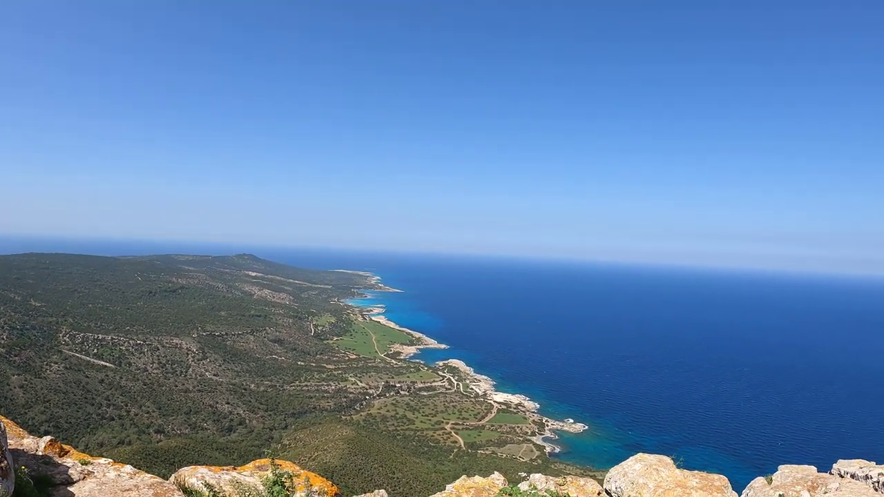 Akamas, Paphos
The Aphrodite Trail offers one of the most compelling hiking experiences on the Akamas Peninsula, combining elevated coastal scenery with a demanding route through rugged countryside.
Beginning near the Baths of Aphrodite, close to Latchi, the approximately 7.5-kilometer circular route climbs above the coastline. From the higher sections, views extend toward Cape Arnaoutis, Polis Chrysochous, the Mediterranean, and the Paphos Forest.
The changing elevation is central to the experience. Instead of following a relatively level coastal path, hikers move uphill into the landscape before descending again toward the starting area.
The route also passes Pyrgos tis Rigainas, where the ruins are associated with a medieval monastery, and an oak tree estimated to be around 500 years old.
Allow approximately three to four hours. The trail is officially graded difficult, with significant uphill and downhill sections, rocky terrain, and exposure to the sun.
Aphrodite is particularly well suited to experienced walkers who want to explore Akamas beyond the beaches and coastal roads. Its demands are part of the decision: travelers interested primarily in a shorter walk with elevated views may find Pissouromoutti a better fit.
There is also a separate Aphrodite Trail at Cape Greco. The route described here is the longer Akamas circuit.
Pissouromoutti
Trail — A Shorter Akamas Hike
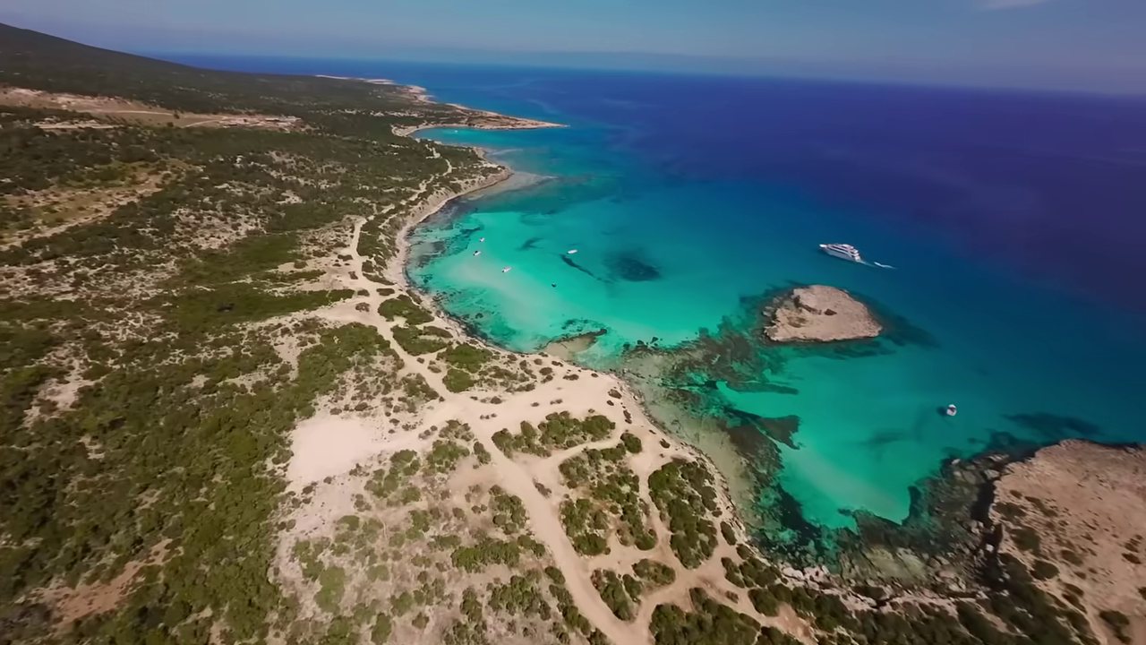 Akamas, Paphos
Pissouromoutti offers a more compact introduction to the hills of Akamas without sacrificing the sense of reaching higher ground.
Starting from the Smigies picnic site, near Neo Chorio, the three-kilometer circular route climbs toward a hilltop approximately 400 meters above sea level.
From the higher sections, the views reach across the peninsula, toward Chrysochous Bay to the north and the Lara and Pegeia coastline to the south. Part of the walk also passes through pine forest, providing welcome changes in scenery and some shaded stretches.
The route is officially classified as moderately difficult, with uphill and downhill gradients that require more effort than the distance alone might indicate. Allow approximately two hours.
Pissouromoutti is appealing when travelers want the reward of a hilltop panorama without committing half a day to a longer hike. It can also fit more comfortably into a wider exploration of western Cyprus.
Its advantage over Aphrodite is the shorter commitment. The compromise is a less extensive journey through Akamas, making it the better choice for walkers who value a rewarding viewpoint over distance covered.
Avakas
Gorge Trail — Limestone Walls and a Narrow River Passage
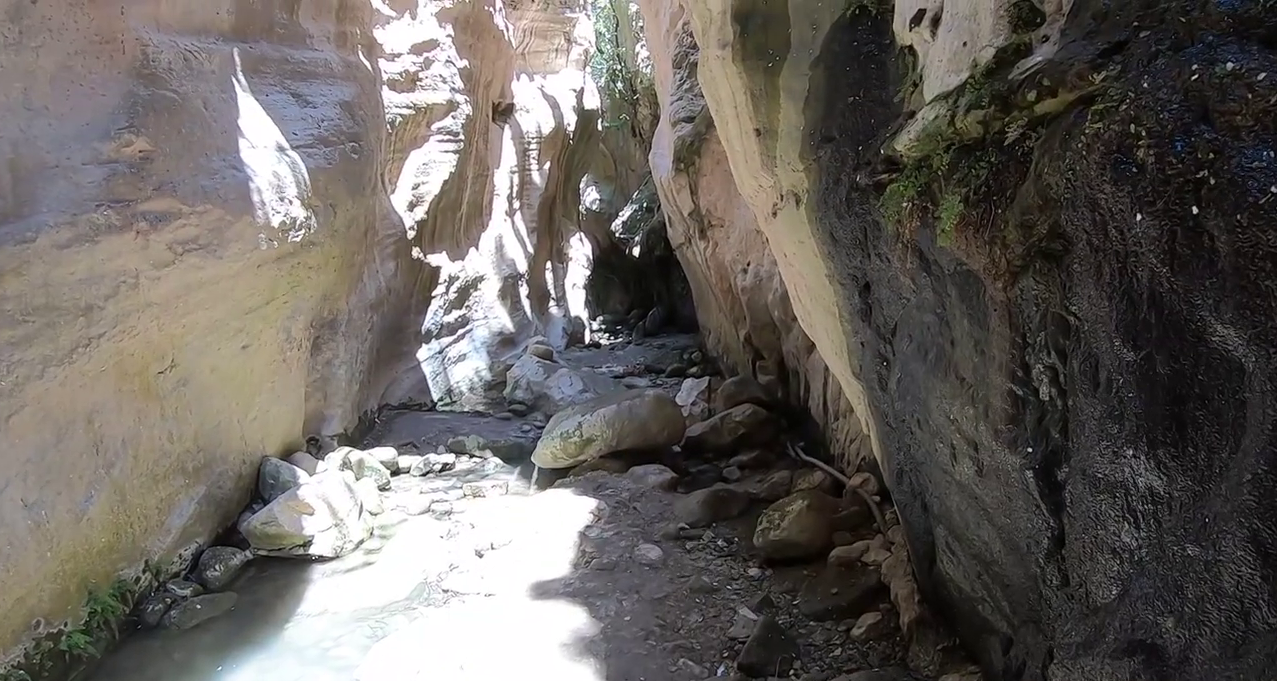 Avakas Gorge, Peyia, Paphos
The Avakas Gorge nature trail follows the Avgas River into a narrow limestone gorge near Pegeia, on the western side of Cyprus.
The gorge was formed through the erosive action of the river on limestone and other sedimentary rock formations over a long geological period. The designated trail begins in a relatively open valley before entering the narrower passage, where high rock walls rise on either side.
When we entered Avakas Gorge, we noticed how the experience changed as the limestone walls rose around us. Instead of looking into the distance, we began paying attention to what was immediately beside us: the towering rock walls, the narrow passage, and the stones beneath our feet. We found ourselves walking more slowly, even though the trail was relatively short. It felt entirely different from walking across an open mountain landscape, where the views often draw your attention toward the horizon.
The designated nature trail is approximately 1.2 kilometers one way, or 2.4 kilometers when returning along the same route. Allow approximately two hours. The first section is classified as easy and the later section as moderately difficult.
River crossings, slippery rocks, and changing water levels require particular attention. There is also a risk of falling rocks, especially during or after wet weather. The official nature trail guide advises wearing a helmet inside the gorge because of this hazard.
Avakas is best suited to walkers interested in geology and an enclosed gorge environment rather than open coastal panoramas. Travelers uncomfortable with wet, uneven ground or the risks associated with a narrow rocky passage should choose another trail.
For elevated views over Akamas, Aphrodite or Pissouromoutti offer more appropriate alternatives. Avakas earns its place because the physical landscape is fundamentally different.
Konnoi–Agioi
Anargyroi Trail — Cape Greco
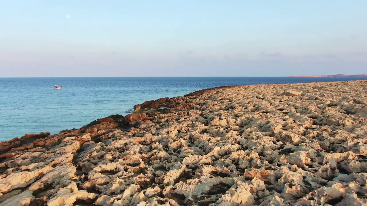 Cape Greco
For travelers based in Protaras or Ayia Napa, the Konnoi–Agioi Anargyroi Trail offers one of the most appealing ways to experience the southeastern coastline on foot.
The approximately 4.8-kilometer circular route passes through Cape Greco National Forest Park, combining views of Konnos Bay with rocky coastal scenery, Mediterranean shrubs, and distinctive natural landmarks.
Beginning from the Konnos Bay area, the route follows the coastline toward the small Agioi Anargyroi chapel, built above a sea cave. Continuing along the marked trail, walkers encounter the natural stone arch known as Kamara tou Koraka before eventually returning through sections of Mediterranean vegetation and pine woodland.
The contrast with the Troodos trails is immediate. Here, the main attraction is the relationship between the rocky coastline and the sea, with the Mediterranean remaining an important part of the surrounding landscape.
The trail is officially classified as easy and generally takes approximately two hours. However, much of the route is exposed to the sun, and walkers should remain on marked paths, particularly around rocky coastal formations.
Konnoi–Agioi Anargyroi is a particularly good fit for travelers wanting a scenic coastal walk without the longer driving journey to Troodos or Akamas.
Those seeking dense forests, running streams, or a challenging mountain hike will find a better match elsewhere on the island.
Which
Hiking Trail Should You Choose?
The right trail depends on the landscape you want to experience and the demands you are comfortable accepting.
For high-altitude forests and mountain views, Artemis offers one of the strongest combinations of scenery and manageable difficulty. Atalanti requires a longer commitment, while Caledonia exchanges open mountain landscapes for woodland, a river, and a waterfall.
Teisia tis Madaris is particularly interesting for its rock formations and exposed mountain views. The walk between Panagia tou Araka and Stavros tou Agiasmati has a different appeal, bringing Byzantine history into the hiking experience.
On the Akamas Peninsula, Aphrodite provides the more substantial coastal hike, while Pissouromoutti offers a shorter route with elevated views. Avakas Gorge stands apart for its limestone formations and the need to pay close attention to the terrain underfoot.
For travelers staying along the southeastern coast, Konnoi–Agioi Anargyroi offers an appealing balance of sea views, manageable distance, and convenient access.
What
to Know Before Setting Out
The official nature trails in Cyprus are generally classified according to three levels of difficulty: easy, moderate, and difficult. These ratings describe the nature of the terrain and the physical demands of the route, but they should not be treated as guarantees of safety or suitability.
Distance is only part of the calculation. Changes in elevation, rough surfaces, river crossings, and exposure to the sun can make a relatively short walk more demanding than a longer route on gentler ground.
In summer, exposed trails in Akamas and Cape Greco can become particularly challenging during the hottest part of the day. Higher-elevation Troodos routes may provide cooler conditions, although mountain weather can change quickly. Winter snow, ice, rain, and strong winds can affect both access and walking conditions.
Wear footwear suited to the terrain, carry sufficient drinking water, and allow additional time for stops or slower progress. Anyone planning a linear route should establish how they will return to the starting point. Mobile reception and digital navigation should not be assumed reliable everywhere.
Some hiking routes may be temporarily closed for safety or maintenance. Before setting out, check the latest information from the Cyprus Department of Forests, particularly if you intend to visit Avakas Gorge. Never enter an officially closed trail or disregard warning signs and access restrictions.
The
Cyprus By Locals Verdict
If we were choosing a hike for a friend, we would ask what they wanted to spend the day noticing—and what they would happily work to reach. A forest circuit, a rocky coastal climb, a waterfall path, and a trail between two Byzantine churches are not competing for the same traveler.
The route worth taking is the one whose demands leave you free to enjoy the place. That matters more than finishing the longest walk or choosing the name everyone knows.