Newsletter "Beyond the Postcards" Subscribe
Plan Your Cyprus Trip: Hotels: Expedia, Villas & Apartments: Vrbo, Car Rentals: DiscoverCars, Tours: GetYourGuide, Airport Transfers: WelcomePickups
- Home
- Things To Do in Cyprus
- Hiking in Cyprus
- Challenging Hikes in Cyprus
Challenging Hikes in Cyprus
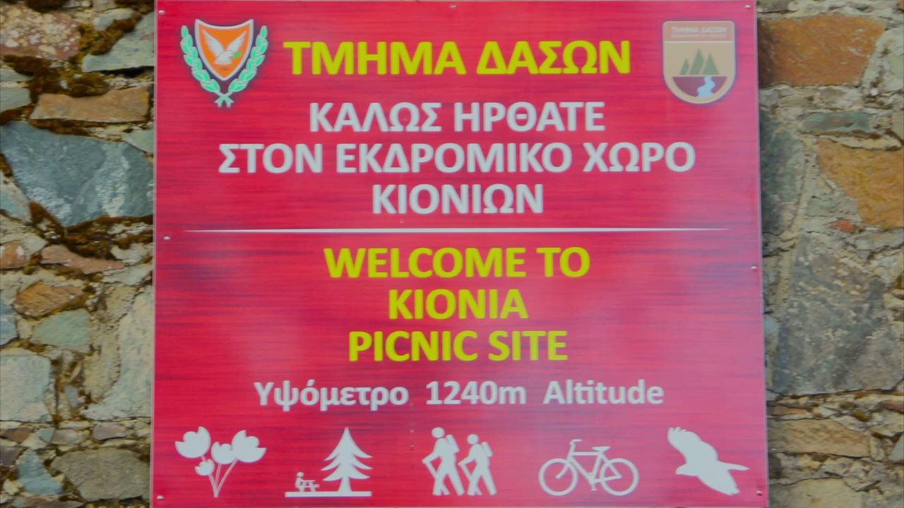
In Machairas Forest, the Kionia–Profitis Ilias Trail runs downhill for seven kilometers. Arrive at the far end without arranging transportation, however, and the return becomes an entirely different proposition: another seven kilometers, this time involving a substantial climb back toward Kionia.
That is one of the distinctions worth understanding before choosing a challenging hike in Cyprus. A trail's published distance may describe only part of the effort involved, while its official difficulty rating cannot tell you everything about the experience ahead.
The island offers demanding routes through mountain forests, over exposed Akamas hillsides, and between historic sites in the Troodos countryside. Some test endurance over several hours. Others require confidence on steep, rocky ground or careful planning around distant starting and finishing points.
We have selected seven hikes for experienced walkers who appreciate a physical challenge but want to know exactly what they are committing to. The question is not simply whether a trail is difficult. It is what makes it difficult, and whether that particular challenge suits you.
What Makes a Hike Challenging in Cyprus?
Cyprus uses a three-level difficulty classification for its nature trails. Grade 3 is the highest, covering routes with demanding gradients, rough ground, narrow sections, or difficult footing. These trails generally require very good to excellent fitness and are unsuitable for young children.
The classification is useful, but it should not be treated as a complete measure of effort. Atalanti, for example, is officially Grade 2 despite its considerable length. Other trails receive Grade 3 classifications because of steep gradients and difficult terrain, even when they cover much shorter distances.
When evaluating a demanding route, we consider three distinct challenges:
Physical endurance: Longer distances and sustained walking, even when the terrain is relatively manageable.
Terrain and elevation: Steep climbs, demanding descents, uneven surfaces, and sections where careful foot placement is essential.
Route planning: Linear trails, remote finishing points, and journeys where the return requires as much consideration as the outward walk.
These differences become especially important in Cyprus, where a forested mountain route may offer a very different walking experience from an exposed trail in Akamas.
Seven Challenging Hikes in Cyprus
1. Psilo Dentro–Pouziaris Trail, Troodos Mountains
Distance: 9 km, circular
Estimated walking time: 3–4 hours
Official difficulty: Grade 3
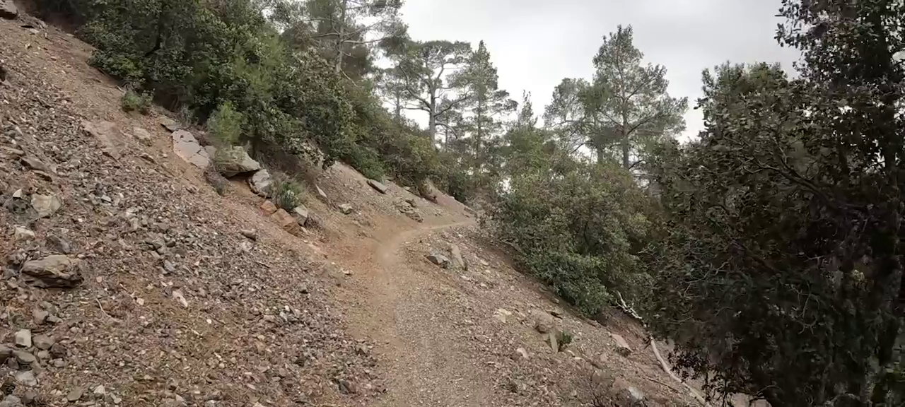 Pouziaris Trail, Troodos
Near Platres, the Psilo Dentro–Pouziaris Trail offers a substantial mountain hike through changing forest environments. Beginning near Psilo Dentro, the route climbs from lower elevations through Calabrian pine woodland toward areas of black pine.
The difference between the trail's lowest and highest points is approximately 500 meters. Its difficulty comes from the sustained climbing and descending, rather than from one particularly demanding section.
As the route gains height, the surroundings change. The forest gradually reveals higher mountain landscapes, while occasional openings provide views toward the southern part of Cyprus.
The sustained physical effort makes Pouziaris more demanding than a relatively gentle woodland walk. It requires stamina on the ascent and care during the descent, with the changing mountain surroundings providing much of the attraction.
For hikers staying near Platres who enjoy climbing through forest, this is a particularly appealing choice. The trees provide some shelter from the sun along parts of the route, although exposed sections and changing weather must still be considered.
The main drawback is the effort required throughout the circuit. The descent can be tiring after the climb, particularly where the ground is loose or slippery. Travelers looking for a gentler forest experience would be better served by one of the shorter, less demanding Troodos nature trails.
2. Madari Nature Trail, Adelfoi Mountains
Distance: Approximately 13 km, circular network
Estimated walking time: Approximately 5.5 hours
Official difficulty: Grade 3
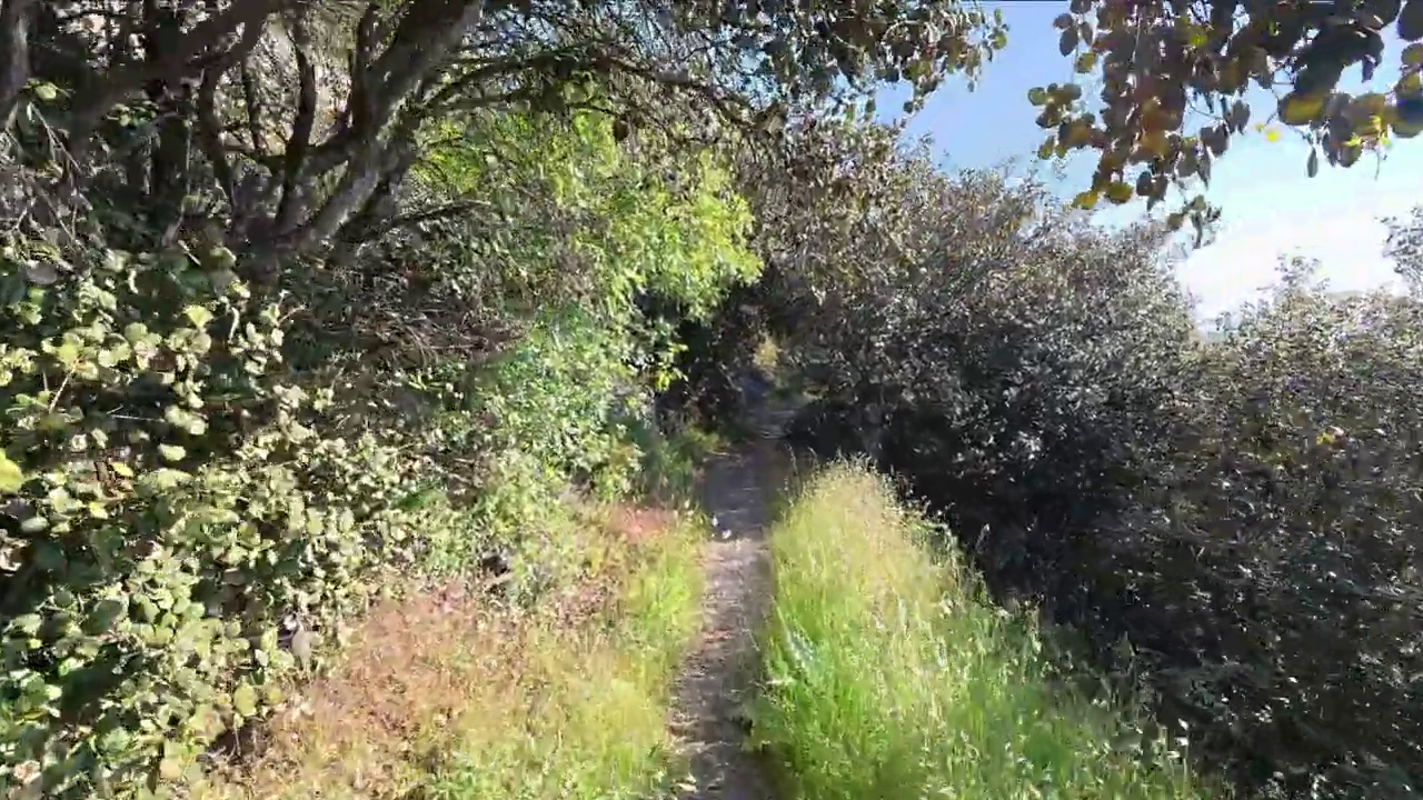 Madari Trail
Madari is not simply a route to a mountain viewpoint. Its full circular circuit brings together four connected linear trails, creating a longer journey through the rugged Adelfoi landscape.
The network links the Madari Fire Lookout, Selladi tou Karamanli, Moutti tis Choras, and Doxa Soi O Theos. Following the complete circuit involves substantial walking through terrain that alternates between forested hillsides and more open mountain sections.
Near the higher elevations, views extend across the surrounding mountains. The Madari Fire Lookout provides a recognizable landmark near the summit of Adelfoi, but the wider attraction lies in the changing scenery encountered along the route.
The full circuit appeals to walkers who enjoy spending much of the day in the mountains. It offers a greater sense of progression than a short climb to a single viewpoint, although that benefit comes with a significant commitment of time and energy.
The connected network also introduces a navigational consideration. Hikers need to understand how the four sections join together, rather than assume that every junction will be immediately obvious.
Those attracted to Madari's mountain landscape but reluctant to commit to the entire circuit can consider Doxa Soi O Theos–Madari Fire Lookout. This shorter, officially difficult linear trail covers 3.8 kilometers, with the return journey adding to the overall distance. The full circuit offers the more substantial mountain experience, while the shorter approach concentrates the effort on a particular section.
3. Aphrodite Trail, Akamas Peninsula
Distance: 7.5 km, circular
Estimated walking time: 3–4 hours
Official difficulty: Grade 3
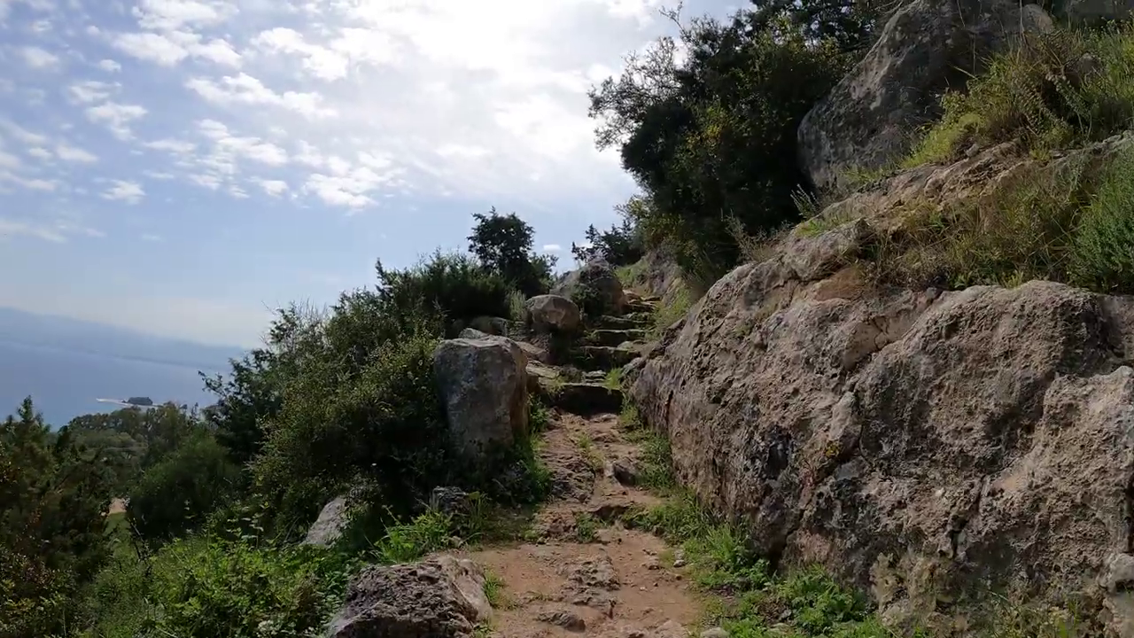 Aphrodite Trail, Akamas
The Aphrodite Trail offers a very different challenge from the forested mountains of Troodos. Its attraction is the opportunity to gain height above the Akamas coastline, where the rugged hillsides meet the Mediterranean.
Starting at the Baths of Aphrodite, the circular trail climbs through rocky terrain toward higher ground. From the elevated sections, views extend toward Cape Arnaoutis, Polis Chrysochous, and the surrounding coastline.
The route also passes near Pyrgos tis Rigainas, the remains of a medieval structure, and an old oak tree that provides a distinctive landmark in the landscape.
Aphrodite's strongest quality is the relationship between the climb and the scenery. The views become more expansive as the trail gains elevation, giving walkers a perspective on Akamas that cannot be appreciated from the coastal road.
However, its relatively modest distance can be misleading. Uneven surfaces, exposed sections, and demanding gradients make the walking strenuous, particularly when the weather is warm.
For experienced hikers whose main interest is elevated coastal scenery, Aphrodite is our preferred Akamas route. The combination of rugged hillsides and Mediterranean views gives the walk a distinctive character, although it is less appealing to those who dislike rocky descents or prolonged exposure to the sun.
The circular route returns to the Baths of Aphrodite, so sufficient energy and time must be reserved for completing it. Our Hiking in Akamas guide examines the wider choice of trails across the peninsula and their different characteristics.
4. Adonis Trail, Akamas Peninsula
Distance: 7.5 km, circular
Estimated walking time: 3–4 hours
Official difficulty: Grade 3
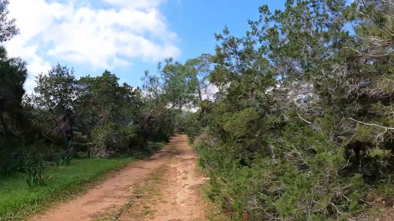 Adonis Trail, Akamas
Adonis shares part of the wider hiking landscape with Aphrodite, but the two routes should not be treated as interchangeable simply because they have similar distances and official difficulty ratings.
Where Aphrodite's strongest attraction is the coastline, Adonis introduces a broader perspective on the hillsides and inland surroundings of Akamas.
Its views extend toward Polis Chrysochous, Paphos Forest, and the surrounding countryside. The trail also passes Pyrgos tis Rigainas and connects with the walking network near Kefalovrysia.
Rocky surfaces and gradients provide the physical challenge, while the open countryside creates a different atmosphere from the enclosed forests of Troodos.
Adonis has greater appeal for walkers who enjoy the wider geography of the peninsula and are interested in more than coastal panoramas. Its combination of inland hillsides and distant views makes it a worthwhile alternative to Aphrodite without merely repeating the same experience.
One practical difference deserves particular attention. The final approximately 400 meters follow the main road leading toward the Baths of Aphrodite.
That road section changes the character of the finish and requires awareness of passing traffic. It is not a reason to dismiss the trail, but it is worth knowing before choosing it.
If coastal scenery is the deciding factor, Aphrodite retains our preference. If the surrounding hillsides and inland views are equally important, Adonis deserves consideration on its own merits.
5. Kionia–Profitis Ilias Trail, Machairas Forest
Distance: 7 km, linear
Estimated walking time: Approximately 2.5 hours, one way
Official difficulty: Grade 3
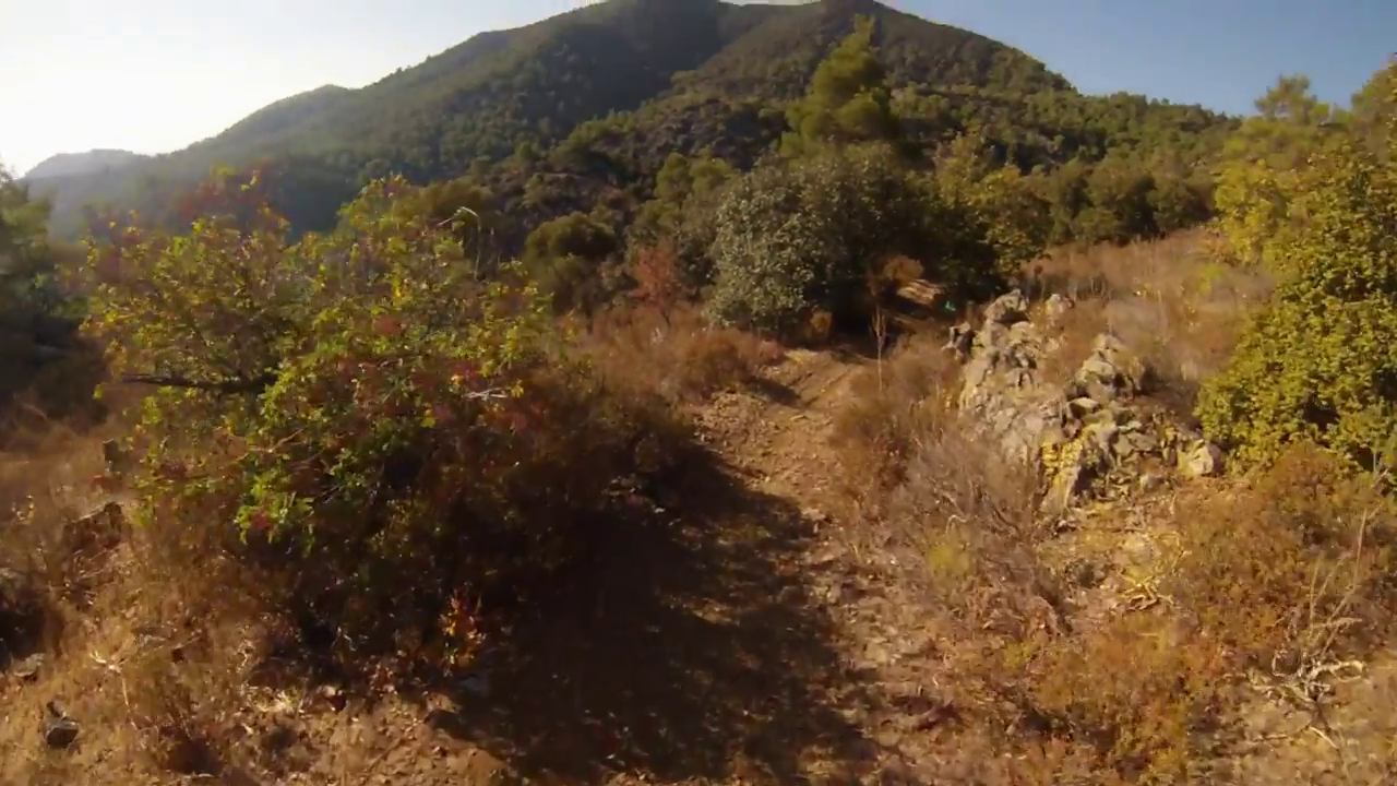 Kionia-Profitis Ilias Trail, Machairas Forest
A demanding hike does not always involve climbing toward a summit. Kionia–Profitis Ilias demonstrates how a prolonged descent can become the principal physical challenge.
The trail begins at the Kionia picnic site, approximately 1,251 meters above sea level, and descends through Machairas Forest toward Profitis Ilias, finishing at around 677 meters.
That represents a net loss of more than 570 meters in elevation. The landscape includes forested surroundings and views toward the Mesaoria Plain, but the demanding terrain requires attention throughout the descent.
Walking downhill for an extended period places repeated demands on the legs. On uneven ground, controlling each step can become increasingly tiring, particularly as fatigue begins to affect balance and concentration. The steeper sections closer to the end are especially important when assessing whether the route is appropriate for your abilities.
This trail suits hikers who are comfortable with sustained downhill walking and have already organized transportation from the finishing point. Without a suitable pickup or other return arrangement, retracing the trail would create a roughly 14-kilometer outing, including a substantial uphill return.
A route chosen for its relatively short distance can therefore become a demanding full return hike, with the greatest climbing effort occurring after the initial descent.
Walkers unfamiliar with extended downhill terrain may find another route more enjoyable. For those comfortable with the physical demands and able to resolve the transport arrangements, Kionia–Profitis Ilias offers a distinctly different kind of challenge.
6. Panagia tou Araka–Stavros tou Agiasmati Trail, Adelfoi Forest
Distance: 7 km, linear
Estimated walking time: Approximately 3 hours, one way
Official difficulty: Grade 3
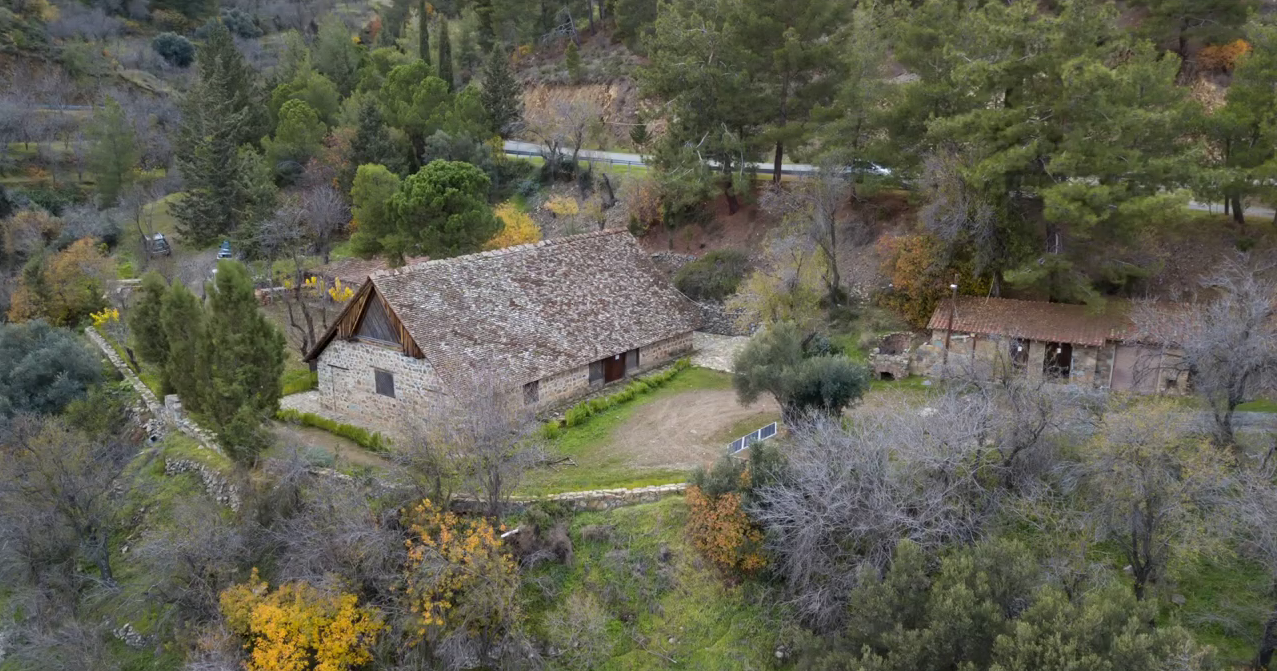 Stavros tou Agiasmati Church (UNESCO), Platanistasa
The trail between Panagia tou Araka and Stavros tou Agiasmati offers something unusual among Cyprus's demanding walks: a physically challenging route linking two significant Byzantine churches.
Panagia tou Araka lies near Lagoudera, while Stavros tou Agiasmati is situated near Platanistasa. Both belong to the UNESCO-listed Painted Churches in the Troodos Region, recognized for their Byzantine frescoes and historical importance.
Between the two churches, the route passes through mountain countryside that includes pine woodland, vineyards, and cultivated landscapes. Views across the surrounding hillsides add to the variety of the walking experience.
Its appeal is not limited to the terrain. For travelers interested in Cyprus's history, the churches provide a cultural dimension that distinguishes this hike from routes chosen primarily for their natural scenery.
The physical effort remains significant, however. Grade 3 terrain requires suitable fitness and careful footing, particularly where the ground becomes steep or uneven.
The combination of difficult walking and Byzantine heritage makes this an especially rewarding option for hikers with a strong interest in the island's cultural history. Rather than concentrating entirely on the surrounding landscape, the walk connects two places of considerable historical importance.
Its principal limitation is the linear layout. Reaching the second church does not return walkers to their starting point, and retracing the trail would double the distance. Transportation should therefore be arranged before departure, unless the longer return journey is deliberately planned and appropriate for the hikers involved.
Visitors hoping to enter either church should also check current visiting arrangements. Their cultural importance does not mean they will necessarily be open when you arrive.
7. Atalanti Trail, Troodos Mountains
Distance: 14 km, circular
Estimated walking time: 4–5 hours
Official difficulty: Grade 2
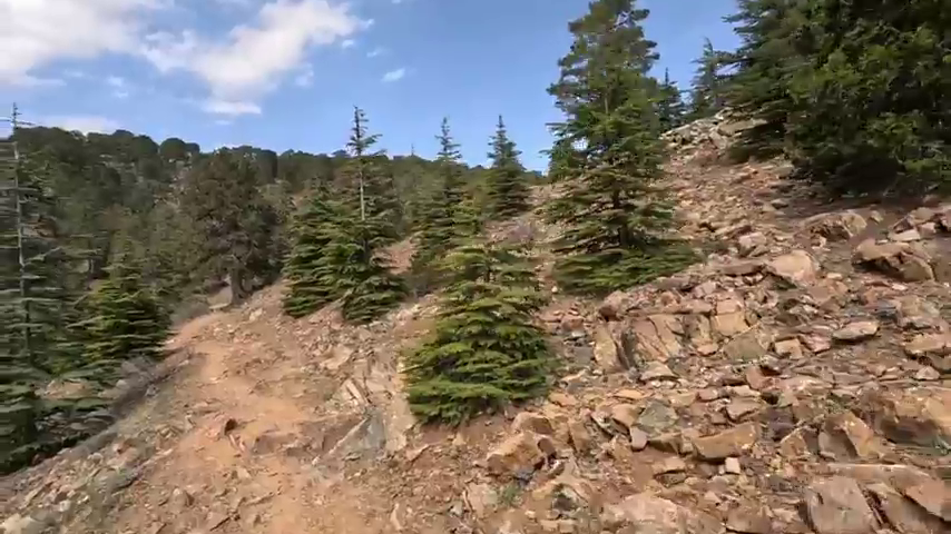 Atalanti Trail, Troodos
Atalanti belongs in this collection for a different reason from the Grade 3 trails.
It is officially classified as moderately difficult, yet walking 14 kilometers through the Troodos Mountains requires stamina. Its challenge comes from sustained effort over several hours rather than particularly steep or technically difficult terrain.
Starting at Troodos Square, the circular route follows the mountain landscape around Mount Olympus. Black pine forest, elevated surroundings, and occasional viewpoints provide the scenery throughout the walk. The trail also crosses the Troodos–Prodromos road, where walkers must pay attention to traffic before continuing along the designated path.
Compared with the steeper Psilo Dentro–Pouziaris Trail, Atalanti has relatively moderate changes in elevation. That makes it appealing to hikers who enjoy covering longer distances without the same concentration of demanding climbs and descents.
Having walked Atalanti, we believe the most enjoyable approach is to give it your entire morning rather than treat the 14 kilometers as a task to finish as quickly as possible.
Walking that distance is not effortless, even for someone who enjoys hiking. However, when the experience is approached as several hours spent in the mountains, the distance becomes part of the pleasure rather than simply a number to complete.
We prefer an early start, especially during summer, before the day becomes too warm. Allowing approximately four and a half hours is reasonable, although individual fitness, pace, and stops along the way will affect the total time.
Comfortable hiking shoes, sufficient drinking water, and snacks are important preparations. For travelers who enjoy photographing nature, taking a camera can add another dimension to the morning, provided they allow time for stopping along the way.
There is also a pleasant way to finish Atalanti that distinguishes it from many of the island's more remote hiking routes. Because the circular trail returns to Troodos Square, there is no need to organize transportation from a distant endpoint. After the walk, we recommend finding somewhere to enjoy a coffee or a refreshing drink, then browsing the kiosks selling traditional local products.
Choose something you would like to taste and take a seat on one of the benches overlooking the mountain surroundings. After several hours on foot, spending a little more time in Troodos Square can be a satisfying conclusion to the morning.
That combination of a substantial hike and a relaxed finish makes Atalanti particularly appealing to travelers who enjoy walking but do not necessarily want their entire day to revolve around a difficult mountain ascent.
Atalanti is not the strongest choice for someone specifically seeking steep, technical terrain. Its appeal lies in endurance, mountain scenery, and the opportunity to enjoy a complete morning outdoors at a more measured pace.
Which Challenging Hike Should You Choose?
These seven routes demand different kinds of effort, so the most suitable choice depends on what you enjoy about demanding walks.
Psilo Dentro–Pouziaris is our strongest choice for sustained climbing through forest. Its changing elevation and mountain surroundings make it particularly appealing to hikers based near Platres.
Madari offers a longer, more demanding mountain circuit. The connected trail network provides extensive mountain scenery, although its distance and navigational requirements call for a greater commitment.
Aphrodite is our preference for elevated Mediterranean views. Adonis makes an appealing alternative when the wider Akamas hillsides and inland landscapes are equally important.
Kionia–Profitis Ilias presents a specialized downhill challenge. It is most appropriate for walkers comfortable with prolonged descents who can organize transportation from the finishing point.
Panagia tou Araka–Stavros tou Agiasmati combines demanding hiking with cultural heritage. Its historic churches give the journey a different purpose from a conventional mountain outing.
Atalanti appeals to endurance-focused walkers rather than those seeking the highest difficulty rating. Its long circuit and return to Troodos Square allow a substantial hike to become part of a leisurely day in the mountains.
Choosing among them should come down to the kind of terrain, effort, and overall experience you want, rather than treating the highest difficulty rating as an achievement in itself.
Why The Descent And Return Matter
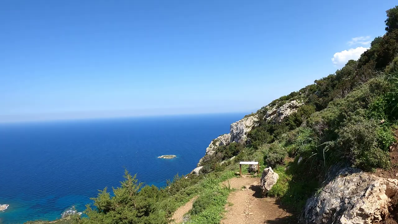 Aphrodite Trail, Akamas
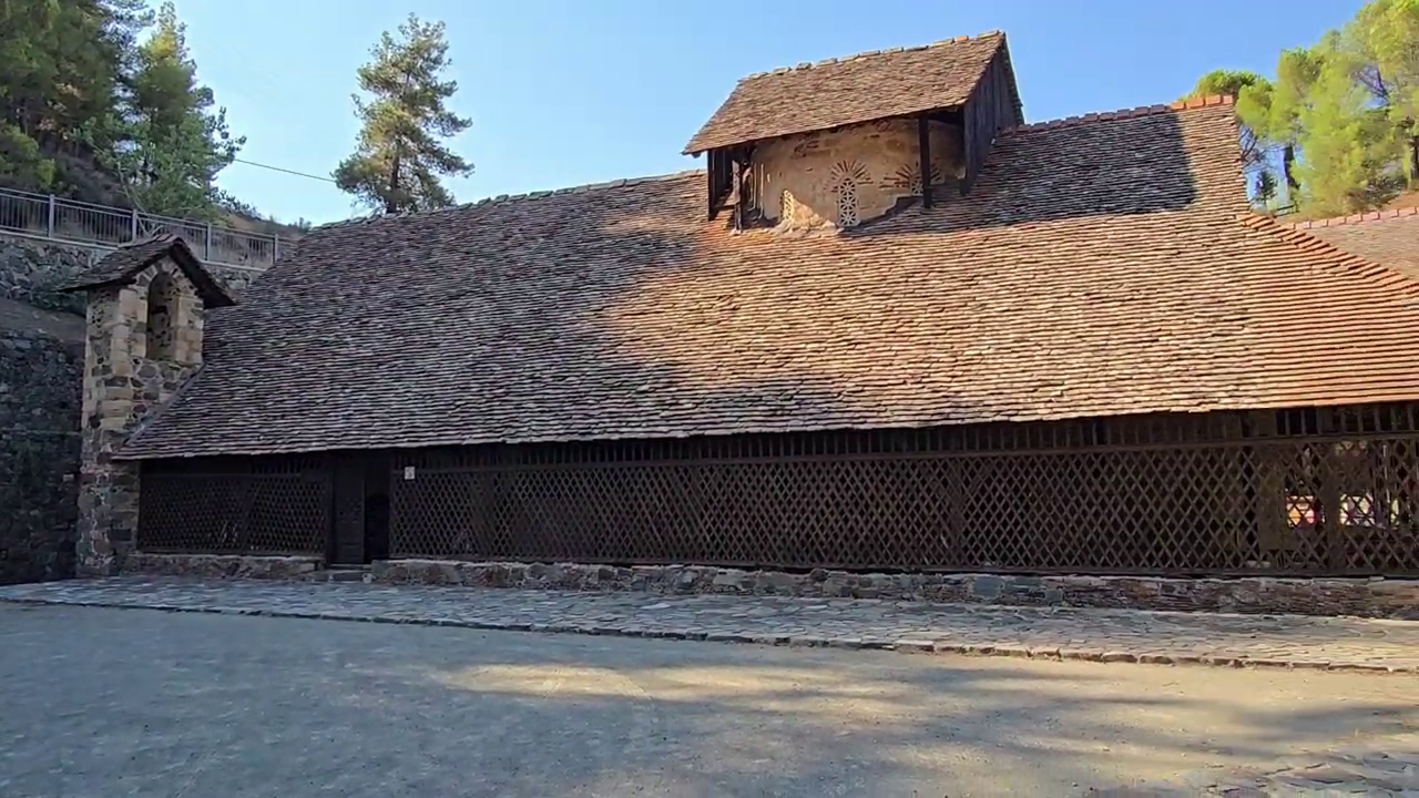 Panayia tou Araka Church (UNESCO), Lagoudera
A viewpoint or summit can appear to mark the end of a demanding section, but it rarely marks the end of the physical effort.
On circular routes such as Aphrodite and Psilo Dentro–Pouziaris, the published distance generally includes the complete circuit. However, descending over uneven ground can become increasingly demanding as fatigue develops.
Linear trails require a different approach. Kionia–Profitis Ilias, Panagia tou Araka–Stavros tou Agiasmati, and the shorter Madari ascent all finish at points separate from their starting locations.
The practical distinction is whether the planned outing ends at the trail's advertised finishing point or includes a return on foot. Retracing a linear route may introduce additional climbing, substantially increasing the time and energy required.
Before departure, establish the complete distance, expected elevation changes, and return arrangements. A hike should be evaluated as a full outing, not simply as a journey toward its most attractive viewpoint.
When To Attempt Challenging Hikes in Cyprus
Spring and autumn generally offer appealing conditions for demanding hiking, particularly in lower-elevation areas where warmer temperatures can make prolonged walking uncomfortable.
Akamas requires particular consideration because many sections of its trails are exposed. Steep terrain combined with direct sunshine can make the physical effort considerably greater than the distance initially suggests.
The Troodos Mountains provide a different seasonal environment. Their higher elevations are generally cooler than the coastal lowlands, although mountain weather, exposed ridges, and changing conditions still require attention.
In summer, an early start can help reduce exposure to the strongest heat. However, starting early does not automatically make a demanding route appropriate during a heat warning or unusually hot weather.
Winter presents other challenges. Rain, snow, ice, and slippery surfaces can affect mountain trails, while poor visibility or strong winds may make exposed sections difficult or unsafe.
We would consider both the season and the individual trail before deciding whether to hike. A route that is manageable in mild conditions may be unsuitable during extreme heat, heavy rain, or winter weather.
Preparing For a Challenging Hike
Experienced hikers will already understand the importance of appropriate footwear, navigation, and adequate supplies. In Cyprus, however, several practical considerations deserve particular attention.
Begin by checking the complete route. Establish whether it is circular or linear, identify its elevation changes, and examine any road crossings, junctions, or sections requiring particular care.
Carry sufficient drinking water and food for the entire planned outing, together with sun protection, a charged phone, and reliable navigation information. Do not assume that drinking water, mobile reception, or clear trail markings will be available throughout the walk.
Allow enough daylight to complete the route without rushing, including any return on foot. On steep descents, tiredness can affect concentration and balance, increasing the importance of careful footing.
Conditions and access can change because of weather, fire risks, maintenance, or official restrictions. Consult current information from the Cyprus Department of Forests and other relevant authorities before departure, follow posted notices, and never enter closed or restricted areas.
No published route description, difficulty grade, or estimated walking time can establish that a hike will be safe or suitable for an individual on a particular day. If conditions deteriorate, navigation becomes uncertain, or the terrain exceeds your abilities, turn back where it is safe to do so.
For unfamiliar or especially demanding routes, walking with a suitably qualified local hiking guide may be preferable to attempting the route independently. In an emergency in Cyprus, call 112.
Our Verdict: The Right Hike Has The Right Finish
There is a meaningful difference between completing Atalanti and finishing Kionia–Profitis Ilias.
Atalanti returns you to Troodos Square, where a coffee, a traditional local snack, and a few quiet minutes overlooking the mountains can become part of the experience.
Kionia–Profitis Ilias ends somewhere else entirely. Unless the return has been planned, the completion of the downhill trail may leave you facing a substantial climb back to where you began.
Neither experience is inherently better. Each asks something different of the person undertaking it.
That is how we believe challenging hikes in Cyprus should be chosen: not by their reputation, distance, or most impressive viewpoint, but by understanding the complete journey and deciding whether it offers the experience you genuinely want.
A demanding hike is most satisfying when the route, the physical effort, and the way you finish all feel like parts of the same well-chosen day.